


Arena Mobile is a mobile data collection application (Android and iOS) complementary to the Arena platform. It is designed to empower organizations, governments, researchers, and field practitioners with a reliable, flexible, and efficient solution for gathering high-quality environmental, forestry, socio-economic, and biodiversity data—especially in remote and connectivity-limited locations.
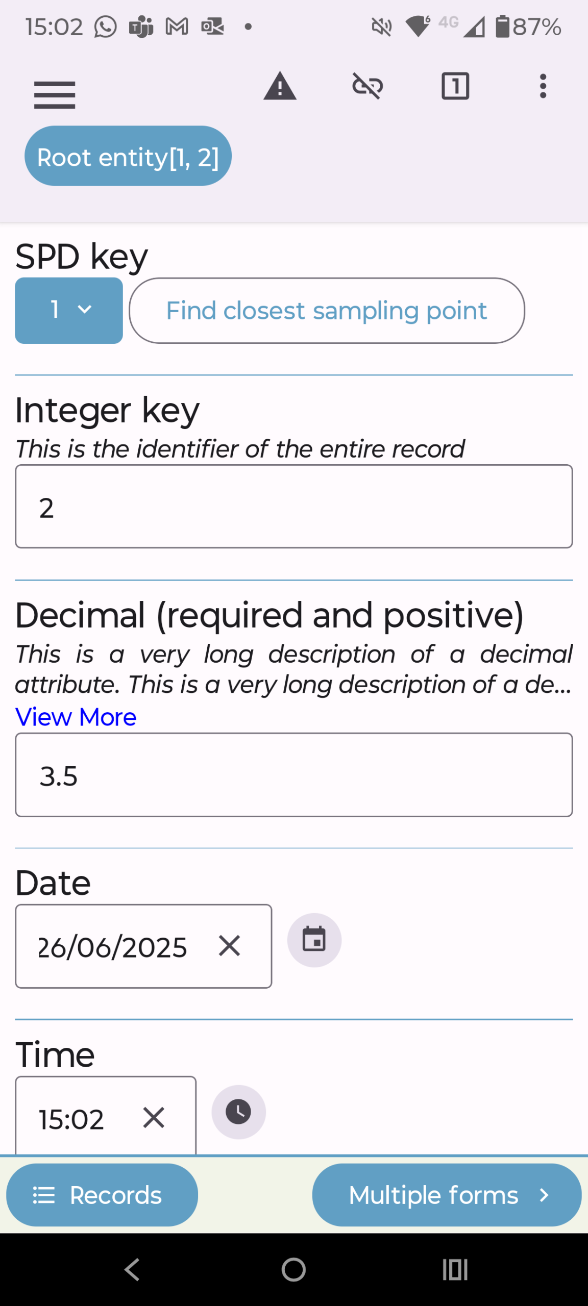
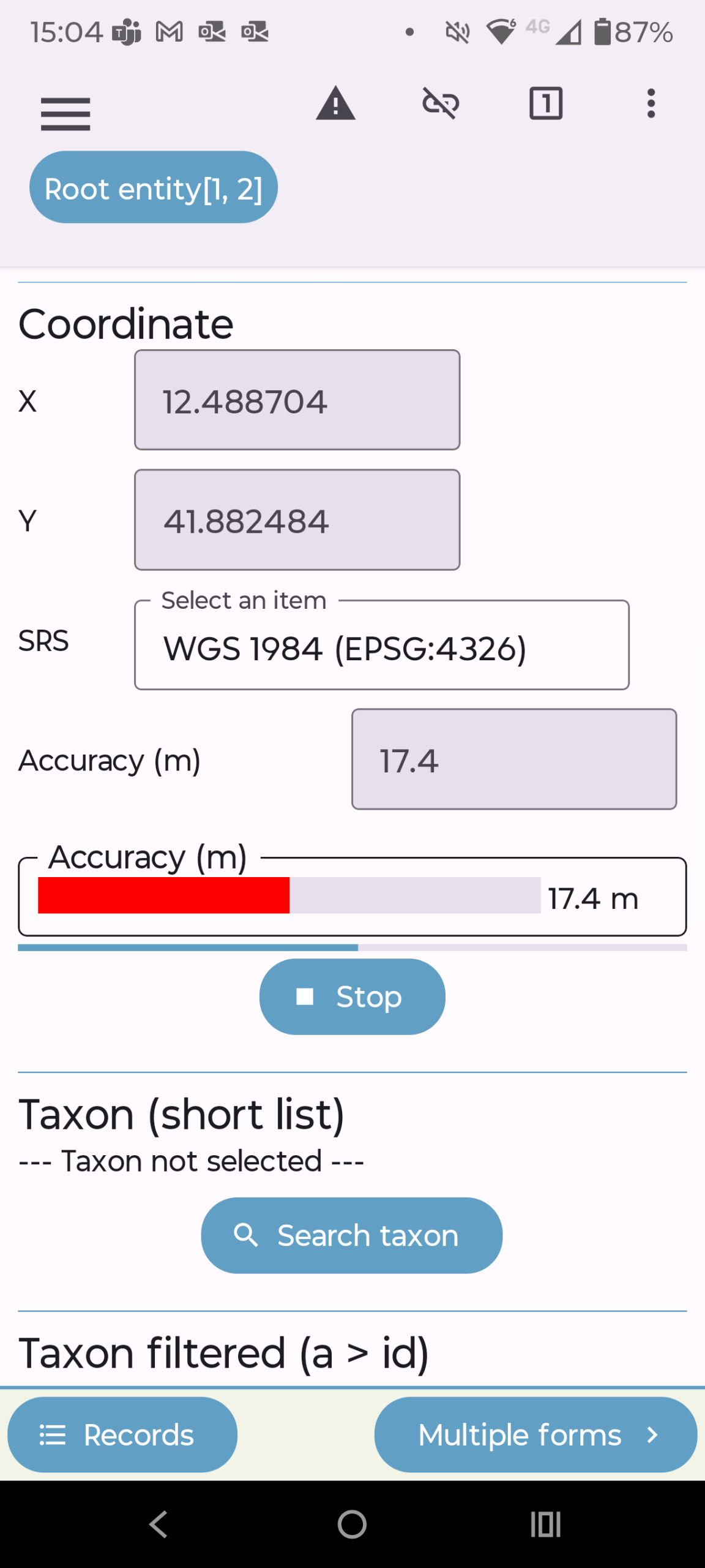
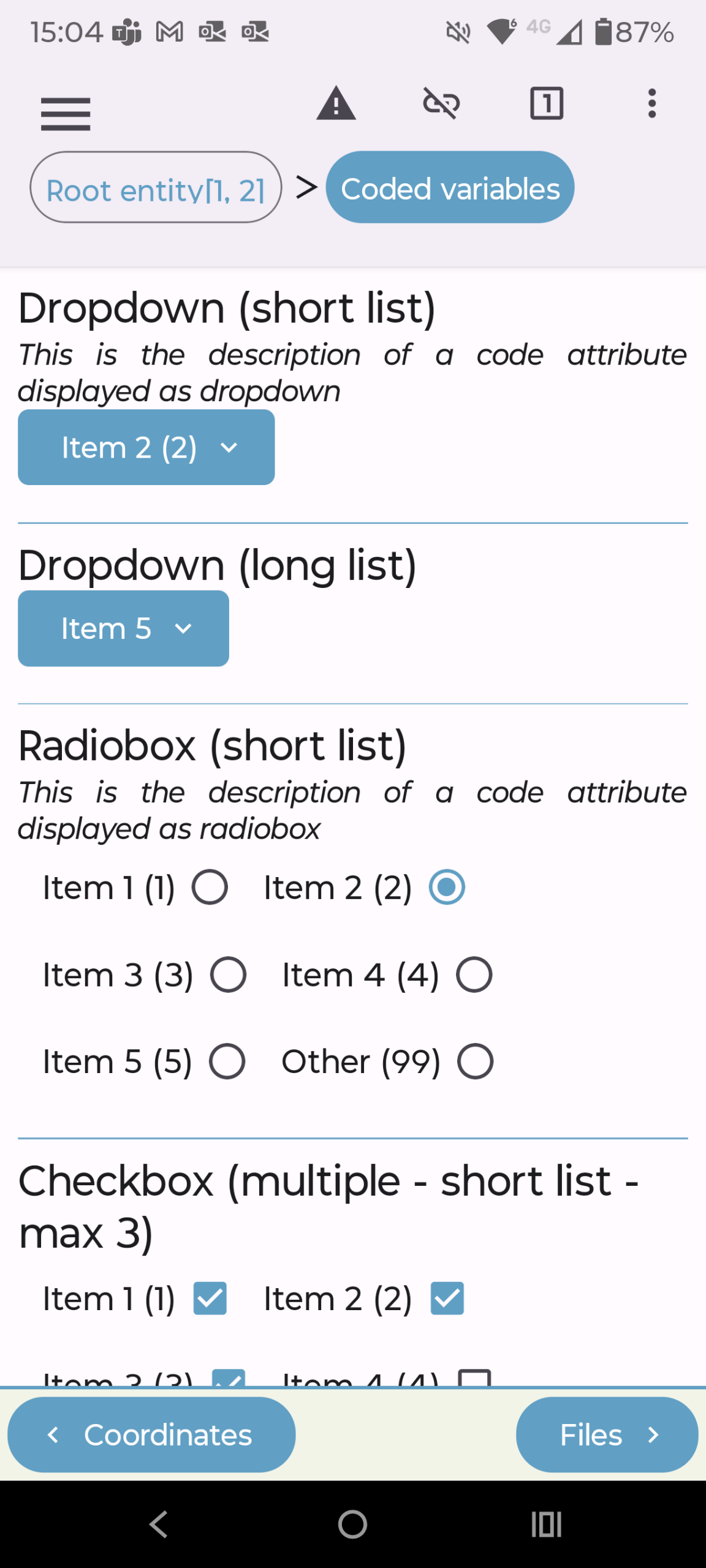
Data collectors can continue their work uninterrupted regardless of internet availability, a frequent challenge in forests, rural communities, or protected areas. The app supports capture of diverse data types, including numeric measurements, GPS locations, images, audio, video, and textual notes, enabling comprehensive data collection tailored to a wide variety of survey needs.
Key Features

Offline Data Collection
Collects data without internet connectivity, enabling fieldwork in remote and challenging environments.
Multi-format Data Capture
Supports numbers, GPS coordinates, images, videos, and text for comprehensive data gathering.
Custom Validation Rules
Allows user-defined data validation to ensure data quality and reduce errors during collection.
Intuitive Interface
Designed for ease of use by field enumerators with minimal training requirements.
Integration with Open Foris Arena
Seamlessly synchronizes data with the Arena cloud-based platform for analysis and reporting.
Open-source, free and secure
Entirely open-source with the source code available on GitHub, promoting transparency and adaptability. Data collected is encrypted in transit, with user privacy respected, and no data shared with third parties by default.
Cross-platform Compatibility
Available on both Android and iOS devices to cover a wide range of users.
Community and Technical Support
Backed by an active community and detailed documentation, tutorials, and forums available on Open Foris and FAO sites.
Designed For
Arena Mobile caters to a broad spectrum of users engaged in field data collection activities related to environmental monitoring, natural resource management, and socio-economic research. Arena Mobile particularly benefits decision-makers through improved data reliability, streamlined workflow from collection to analysis through the integration with Arena for reporting.
Key target audiences and use scenarios include:
National Forestry Agencies
Forestry agencies use Arena Mobile to conduct National Forest Inventories, enabling consistent, large-scale forest data collection and long-term monitoring.
Environmental &
Biodiversity Conservation
Conservation NGOs and researchers leverage Arena Mobile to carry out species inventories, habitat assessments, and biodiversity monitoring in protected areas and biodiversity hotspots.
Climate Reporting
Arena Mobile enables reliable field data collection for reporting under international climate commitments, supporting countries in monitoring forest carbon stock, deforestation, and degradation.
Socio-economic &
Livelihood Data
Researchers and development practitioners use Arena Mobile conducting household surveys, community profiling, and socio-economic assessments in rural or remote areas.
Disaster Risk Management &
Land Use Planning
Entities responsible for land use monitoring, natural disaster assessment, and ecosystem services valuation can utilize Arena Mobile to gather data on land cover, land use changes, and environmental impacts, enhancing responsiveness and informed decision-making.
Academic &
Research Institutions
Universities and research centers adopting Arena Mobile gain a flexible solution to facilitate field data acquisition for ecological, forestry, and social science studies.
Workflow & Architecture
Workflow
- Survey Administrator Logs In and Accesses Arena Platform: The process begins on the web-based Arena platform. A survey administrator (or technical expert) with appropriate credentials logs in.
- Define and Design Survey Structure:
- Using the "Survey Designer" within Arena, the survey designer defines the survey's structure, including entities (e.g., plot, tree, household), attributes (variables like species, diameter, GPS coordinates, land use type), data types, and validation rules.
- Customizable validation rules are crucial for ensuring data quality at the point of collection.
- Optional Feature: If the survey requires taxonomies (e.g., species lists), categories, or specific spatial reference systems (SRS), these cane be configured within Arena.
- Publish Survey: Once designed and tested, the survey is published on the Arena platform, making it available for download by the data collector.
- Field Data Collector downloads Arena Mobile App: Field data collectors download the Arena Mobile application from app the stores (Android/iOS) onto their mobile devices.
- Log In and Download Survey to the Mobile Device: The Data collector logs into the Arena Mobile app using their credentials. The app connects to the Arena platform to list available surveys. The data collector selects and downloads the relevant survey(s) to their device. This step requires an internet connection.
- Offline Field Data Collection:
- Once the survey is downloaded, the data collector can proceed to the field and collect data offline. The app guides them through the survey form, allowing entry of various data types: numerical, text, GPS coordinates, photos, videos and more.
- Validation rules (defined in Phase 1 during the survey design) provide immediate feedback to minimize errors to ensure high-quality data, even without connectivity.
- Data is stored locally on the device (in an SQLite database).
- Return to Connectivity: After completing field data collection, the data collector returns to an area with internet access.
- Upload Data to Arena Server: The data collector opens the Arena Mobile app and initiates the data upload. The app securely uploads the collected data from the mobile device's local storage to the central Open Foris Arena server.
- Data Ingestion and Storage: The uploaded data is ingested by the Arena Platform's application server and stored in its PostgreSQL database (with PostGIS for spatial data).
- Data Validation and Quality Control: Survey administrators and data managers use the Arena's 'data manager' to review the uploaded data. This includes running predefined validation methods, identifying inconsistencies or missing data, and performing data cleaning or editing.
- Multi-Cycle Data Management (if applicable): Arena supports managing data across multiple survey cycles, allowing for monitoring and analysis of changes over time.
- In-Platform Analysis: Arena provides integrated capabilities for basic data analysis and reporting using R or RStudio.
- Advanced Statistical Analysis (RStudio Integration): For more complex statistical analysis, Arena integrates with RStudio Server. Users can run custom R scripts on their data directly from the platform, enabling advanced calculations, modeling, and visualizations.
- Reporting and Visualization: Results are presented through reports, dashboards, and map views within the Arena platform. The map view, for instance, can utilize high-resolution satellite imagery to visualize collected data spatially.
- Data Export: Cleaned and validated data can be exported in various formats (e.g., CSV, shapefiles) for use in other software.
- Inform Decision Making: The analyzed data and reports can be used for forest monitoring and management, land use planning, conservation efforts, and climate reporting.

Technology Stack
- Programming Language: Primarily Java (often with frameworks like Spring Boot).
- Database: PostgreSQL (often with the PostGIS extension for spatial data handling), enabling efficient storage and querying of geographic information.
- Containerization: Docker is heavily used for deployment, allowing for consistent environments and easier management of the various components (Arena, PostgreSQL, RStudio Server).
- Cloud Hosting: Often deployed on cloud platforms (e.g., AWS) for scalability and accessibility.
- GIS/Mapping: Integration with geospatial libraries and potentially external map services for visualization of spatial data.
- Analytics Integration: RStudio Server or local R installations for advanced statistical analysis and data processing.
- Web Technologies: Standard web development stack including HTML, CSS, JavaScript, with a modern JavaScript framework (e.g., React, Vue.js, or Angular – a modern framework is used for rich web UIs).
- Platform: Developed for both Android and iOS, suggesting a cross-platform framework or native development for each. Given the focus on offline capabilities and device feature access (camera, GPS), it uses native capabilities or a strong cross-platform framework like React Native or Flutter, which compile to native code.
- Offline Storage: Utilizes local database solutions on the mobile device (e.g., SQLite) to store survey forms and collected data when offline.
- Synchronization Mechanisms: Implements robust mechanisms for syncing data between the mobile app and the Arena server once connectivity is restored.
Screenshots
Resources
Downloads


Support Forum
Github
Materials & Resources
- Arena User meeting (12/12/2024)
- Fortalecimiento de capacidades con Open Foris Arena, entrevista a Aracelli Medina [SP]
- Fortalecimiento de capacidades con Open Foris Arena, entrevista a David Velarde Falconi [SP]
- Free open-source solutions for forest and land monitoring
- Mexico strengthens communities' involvement in forest monitoring with Open Foris Arena